Delphi Valley

It’s been too long since my last post as I’ve been caught up in the busyness of life and children. I’m returning with a short post  about a couple of new paintings I’ve just started. These are based on the Delphi valley, which must be one of  the most spectacular views here on the edges of Connemara and County Mayo. I’m working on a couple of canvases at the same time, alternating between the two. This one ( above ) is 10″ x 9.5″  – I’ve kept the palette quite cool so far with lots of blue and green. The second piece below is 10.5″ x 7.5″ and I’ve warmed this one up with some pink.


Delphi Valley with pink road, first stage.


I love this shade of pink – I think it’s everywhere at this time of year, not like this of course but you can see it in a haze over the grasses if you squint your eyes.

I’ll take more photos as these paintings progress and post about them again soon.

Inishturk

I joined a group led by Clifden archaeologist Michael Gibbons on a trip to Inish Turk and Caher Island this week. We set out from Cleggan harbour at 9.30am and headed for Caher island first, north east of Turk. It is tiny, uninhabited and difficult to access. The remains of an early Christian monastery survive on the island which is an ancient pilgrimage place and is still visited for this purpose today.


Map of the islands - Turk and Caher

Map of Inishturk and Caher Island 


Unfortunately, we were unable to land on the island as there was quite a big swell even though the day was warm and calm. This was what we saw as we approached – the water was deceptively still, almost black and oily in appearance but it rose up suddenly in bursts which crashed heavily on the rocks at the shoreline.


Caher island just offshore


We turned around then and made our way back to Inishturk, stopping first to marvel at the base of these cliffs – a rupture of black basalt and granite. The light was incredible – it sparkled off the water and diffused as it rose, trapped in the black curve of rock which rises sharply from the water. I wish my photography skills were a bit better – this is my best picture.


Cliffs at Inishturk from the sea


We travelled over to the pretty harbour of Portdoon next ( cover photo ) where we disembarked and started our hike. The island is 5km long by 2.5km wide and we covered a good deal of it in the five or six hours we spent there. The landscape is an eye popping mix of undulating hills and valleys with ancient walls and field systems and dramatic cliff top walks. There’s a spectacular view of the Twelve Bens mountain range in this next one.


turk 1


The diamond shaped hill in the centre distance ( below ) is Croagh Patrick, an important pilgrimage mountain in county Mayo.


The landscape at Inishturk


Me in hiking mode below.


Photo of me in hiking mode


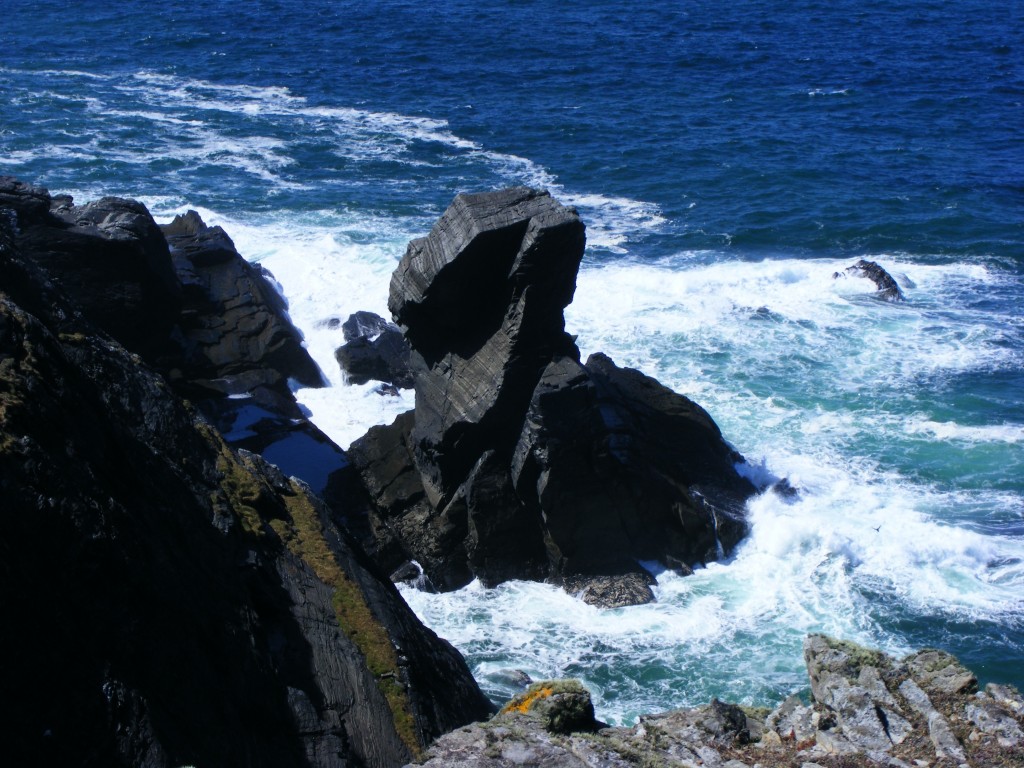
These sea stacks are known in Irish as ‘Buachaill mor’ and ‘Buachail beag’ ( Big boy and small boy ). The cliff views were spectacular and a little scary.


Inishturk cliffs viewed from the island


This next one is known locally as the sphynx – an incredible natural sculpture.


sea stacks at Inishturk


As we completed the loop back to Portdoon, we began to hear the sound of the sheep and their new lambs which dotted this part of the island – they were very willing to pose for photos..


Sheep on Inishturk


Lamb at Inishturk


Lastly, I stopped to take a picture of the post office which also operates as a Bed and Breakfast.

Every single islander we met along the way greeted us warmly and stopped for a chat. I was struck by the thought of living among such a small close community – just forty inhabitants today. This island is less known and travelled compared to it’s neighbours Inishbofin and Clare Island which attract large numbers of tourists in the Summer, but it is no less beautiful. I hope to make a return visit before the end of the Summer.


Inishturk post office